Web Gis 3D Erbil Iraq
Web Gis 3D Erbil Iraq
This demo version of webGIS has been implemented for the LRT Erbil Project.
System Requirements:
- Windows XP SP2 or higher
- Mac OS X "Snow Leopard" 10.6 or higher.
- 3 GB of RAM Recommended 6 Gb of Ram
- Display adapter compatible with DirectX 9 (support for shader model 2.0). Any video card produced after 2004 should work.
- Browser compatible with HTML5 CSS3 (Firefox 20.0.1, Google Chrome 26.0.1410.43, Internet Explorer 10, Safari 5.1.7)
For a smoother experience we recommend:
- Windows 7 x64 o superiore; Mac OS X "Snow Leopard" 10.6 o superiore.
- 6 Gb di Ram
- Display adapter compatible with DirectX 11 (support for shader model 5.0)
- Browser compatible with HTML5 CSS3 (Firefox 20.0.1, Google Chrome 26.0.1410.43, Internet Explorer 10, Safari 5.1.7)
Our case study investigates the possibility of creating a webGIS userfriendly model of a city of Architectural Heritage significance and great Urban development located in Erbil (Kurdistan-Iraq) by processing data obtained through an earlier survey campaign carried out by the ‘FGTecnopolo’ firm.
SYSTEM CONCEPT
Input Data:
• satellite image (December the 3rd, 2010. +GMT time 9:21 a.m.)
• 2D of the buildings
• LRT Netwotk lines
• Position/names of the LRT stops
• Position of the LRT depots
• Points of interest of the City
Description:
In a first stage we have implemented the 2 dimensional model and in a second stage we have exported the model in Postgres (POSTGIS). We have then associated a repository with all the following informations:
• SQ footprint of the buildings;
• P Perimeter of the building;
• ID identification number and name of the building;
• District district name of the building (applying Overlay);
• NAME name of the building;
• TYPE typology description
• H height of the building (actually we have insert the default hight of 3 meters)
Descriptive tour:
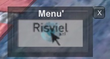
Write the following address: labs.risviel.it
Launching the application with a free download [size 40mb]. It will take few seconds or minutes, depending on the internet connection.
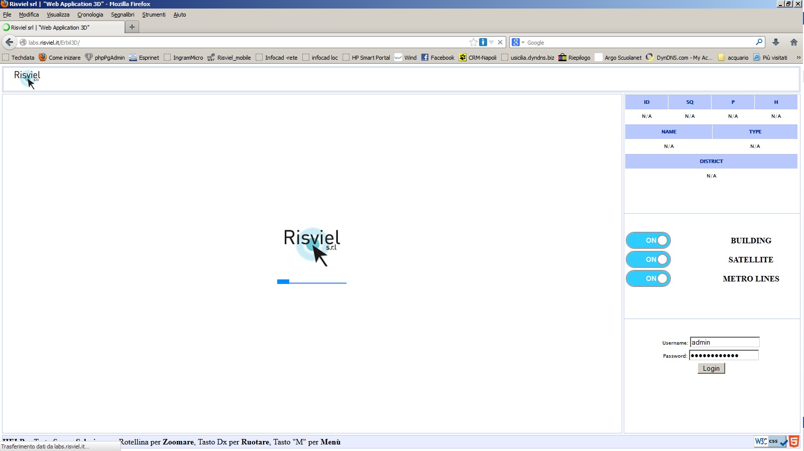
You will see the following image.
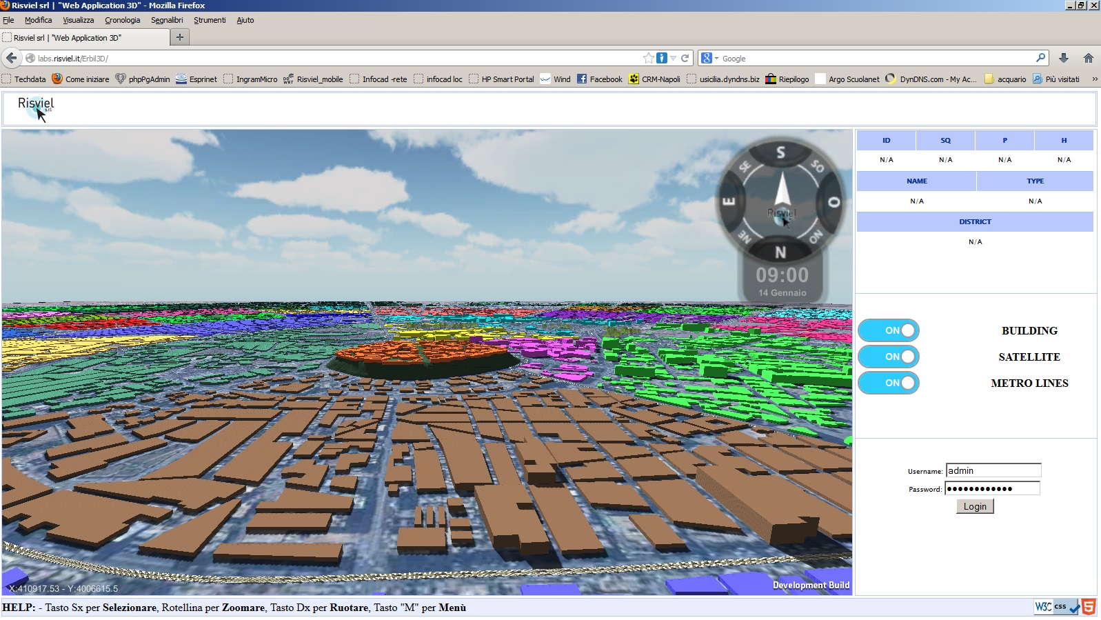
Now you are inside the virtual reality model (the system is reading the data from the repository postgres and upgrading the building heights).
You can move inside the virtual model and interact with objects using your mouse.
By clicking the primary button – left button of the mouse- you select objects (buildings); clicking the secondary button – left button of the mouse- you rotate the model and by using the scroll wheel you can zoom in and zoom.
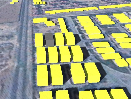
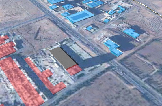
Try to click a building with the primary button – left button of the mouse- this will become grey and will be able to move the building and read the technical specifications of the same.
 |
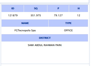 |
As an example you see the FGTecnopolo branch office located in the English Village-Sami Abdul Rahman District. You can read the building technical: ID,SQ,P, H, Location, Name, and Typology.
 |
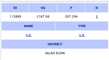 |
You can now select another building. You can see the shadow and read the height of the selected building: 3 meters. We can change the technical data.
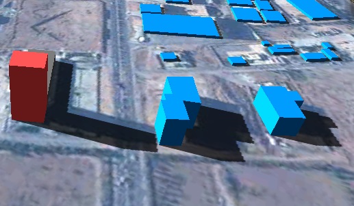
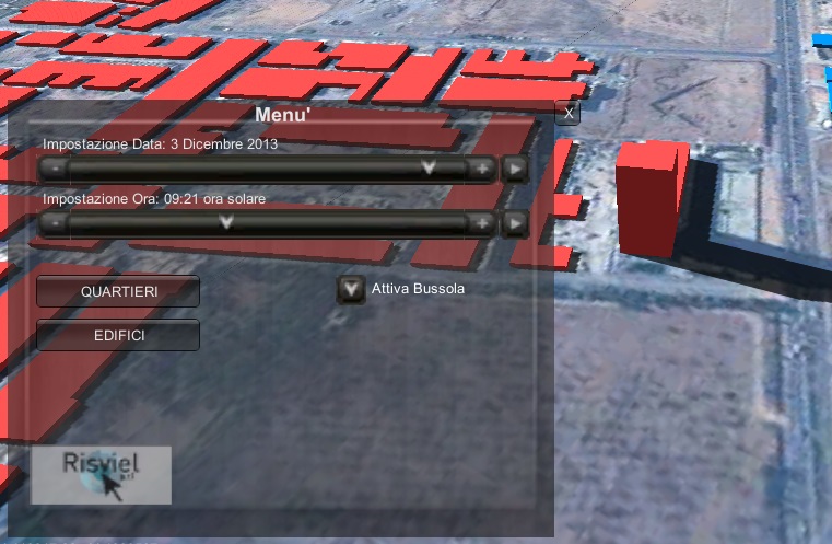
If you press the “M” button of the key board, the buildings will become solid blocks with projecting the shadows corresponding to the hour, date, and year selected.
You can select the date and hour using the “+” or “-“ of the time bar charts
For example clicking on the height we can write 12 meters. The same we can do on the buildings near. Look how the shadows change.