City of Giugliano in Campania Web Gis
City of Giugliano in Campania Web Gis
| Assignment name: Certificate of urban destination. | Customer: Comune di Giugliano in Campania |
| Country: Italia | Duration: 6 month |
| Start date (month/year)Inizio: 2008 | Completion date (month/year): 2008 |
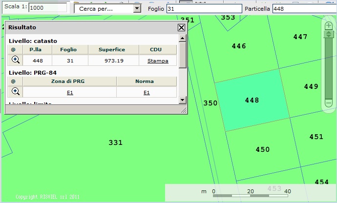
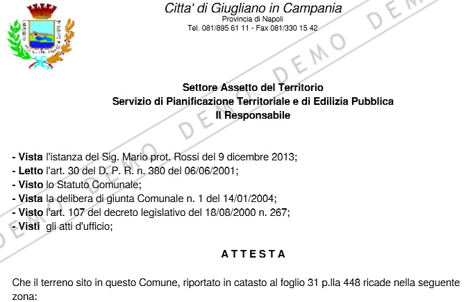
| Narrative description of project: For the realization of this project, it was necessary first of all to make homogeneous the data provided by the authority, and in particular cadastre (Cassini-Soldner) and aerial photography (Gaus-Boaga). It has already created the relevant topologies for the various "layers", made the code for the creation of the Certificate of Town Planning Use Class. About the views and frameworks in the various scales were used various sources using raster data, Orthophoto, Military Geographical Institute Map (1:25.000), the Regional Technical Map (1:10,000); vector data: Buildings, land parcels, General development plan adopted and other utilities plans also have been reported with all data relating to the various constraints. It 'was implemented a research that allows us to identify the particle; Layers can be activated or not through a checkbox. |
|
 |
 |
|
Description of actual services provided by your staff within the assignment: |
|
| Access To Web Gis | |